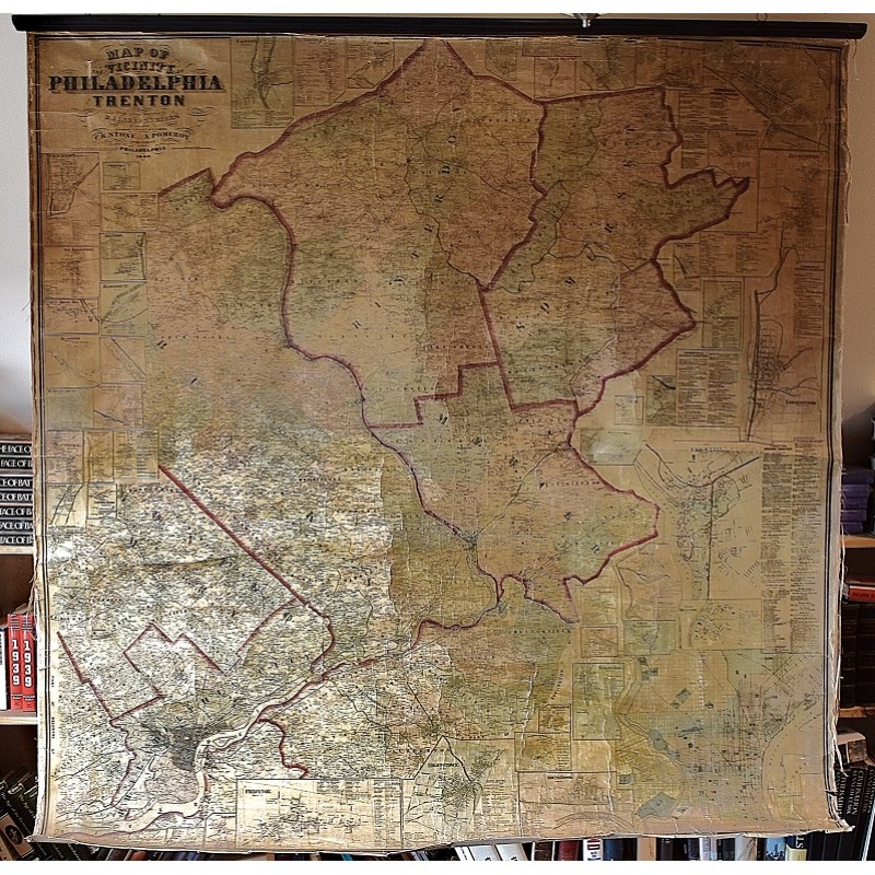
Map of the Vicinity of Philadelphia and Trenton. (Original Color Map)
Click Image for Gallery

Map of the Vicinity of Philadelphia and Trenton. (Original Color Map)
L. B. Lake, D. G. Beers
Philadelphia: C.K. Stone and A. Pomeroy, 1860
65 x 63 inches. Hand colored and lacquered. Only top wooden roller present. Mounted on original linen. Some creasing, chipping, soiling, tears. Includes numerous directories and inset maps mostly of Montgomery County, including: Philadelphia, Wilmington, Kennett Square, West Chester, etc. Shows Gloucester, parts of Camden, Mercer and Burlington County, NJ; 9 towns in Delaware; and the northernmost three towns in Maryland. Scale approximately 1:63,360. 1 inch equals one mile. Ristow, page 397.