An Account of Travels into the Interior of Southern Africa in the Years 1797 and 1798: Including Cursory Observations on the Geology and Geography of the Southern Part of that Continent
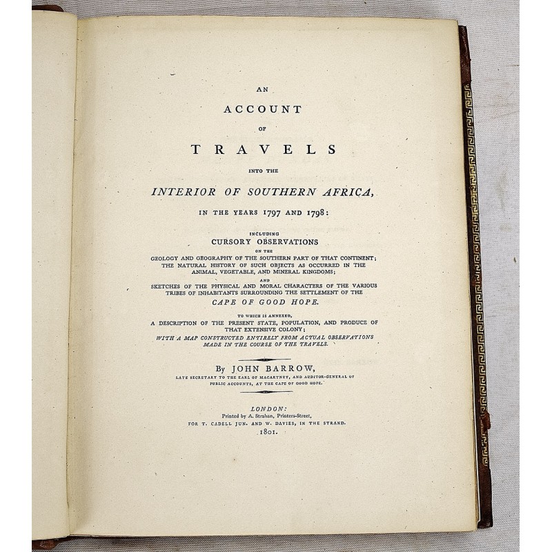


An account of travels into the interior of Southern Africa in the years 1797 and 1798 : including cursory observations on the geology and geography of the southern part of that continent : the natural history of such objects as occured inthe animal, vegetable and mineral kingdons : and sketches of the physical and moral characters of the various tribes of inhabitants surrounding the settlement of the Cape of Good Hope : to which is annexed a description of the present state, population, and produces of that extensive colony : with a map constructed entirely from actual observations made in the course of the travels (2 volumes)
Barrow, John
A. Strahan for T. Cadell Jun. and W. Davies, London, 1801 - 1804
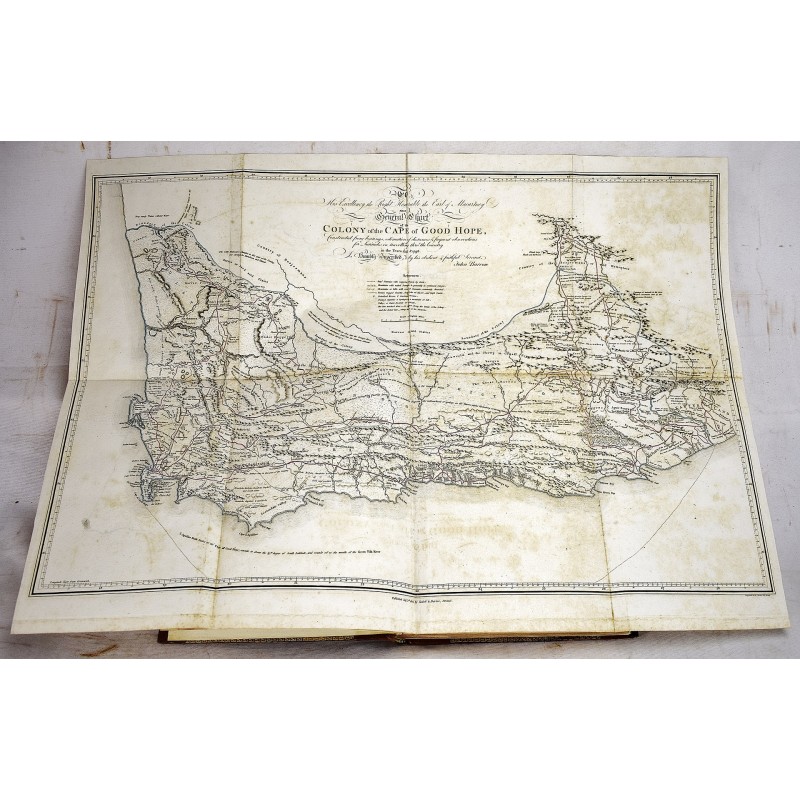
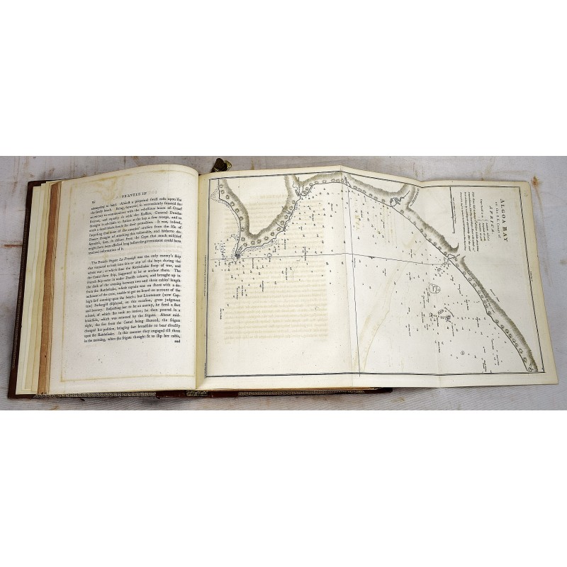
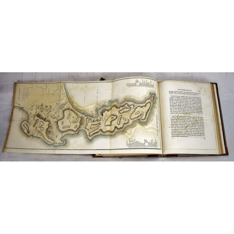
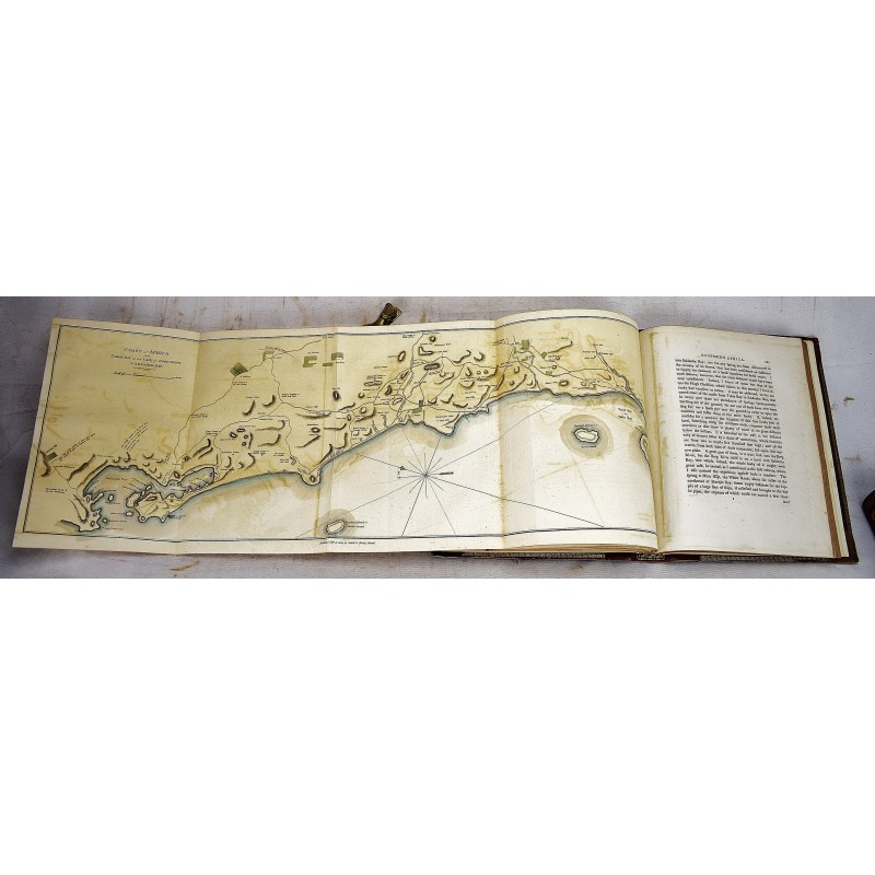
[British Control of South Africa] 2 volume set. 4to, 11 x 9 inches. Bound in contemporary calf, rebacked with renewed spines. Solid bindings. All edges gilt. Renewed end pages. Folding engraved map with hand-coloring, 9 folding maps and plates (some colored); 410 pp., index; 439 pp., index. Scattered spotting. Generally clean, with occasional staining.
Provenance: Contemporary bookplate of Sir Robert D'Arcy. Modern bookplate of Vernon S. Ford, the noted South African geographer. Most recently owned by Arnold "Jake" Johnson, the noted bibliophile of Sporting and travel books.
As an agent of the first Governor of the Cape Colony, Barrow traveled extensively into the interior of Southern Africa. He assigned to reconcile disputes among the Boers, Hottentots, and Kaffers, who were striving to graze and hunt over the same territory, and to map the troubled area. "Barrow's work is, however, only superficially an account of the appearance of the area. Southern Africa was of huge strategic and economic importance to Britain in the late-eighteenth and through the nineteenth century. Until the opening of the Suez Canal in 1869, the quickest route to India and China was via the Cape of Good Hope. It was a perilous journey due to the rough seas around the Cape so having safe harbour was a necessity, whoever owned the Cape could control traffic to India. The Dutch had settled the area in the seventeenth century, but as British power in India grew, the region became a target for conquest. Barrow, rather than including plates of interesting sights; infrastructure; ports; people and picturesque landscapes, as was common in books of this genre, instead focuses purely on illustrating the location of Cape Town and its harbour fortifications in relation to the Cape itself." - Royal Collections Trust. As Barrow states in this work's conclusion: "Having thus endeavoured to state the different points of view in which the Cape of Good Hope may be considered of importance to the British nation, from materials faithfully collected, and of unquestionable authority, the result of the whole will, I think, bear me out in this conclusion: ... that, as a mere territorial possession, it is not, in its present state, and probably never could become by any regulations, a colony worthy of the consideration of Great Britain or any other power."