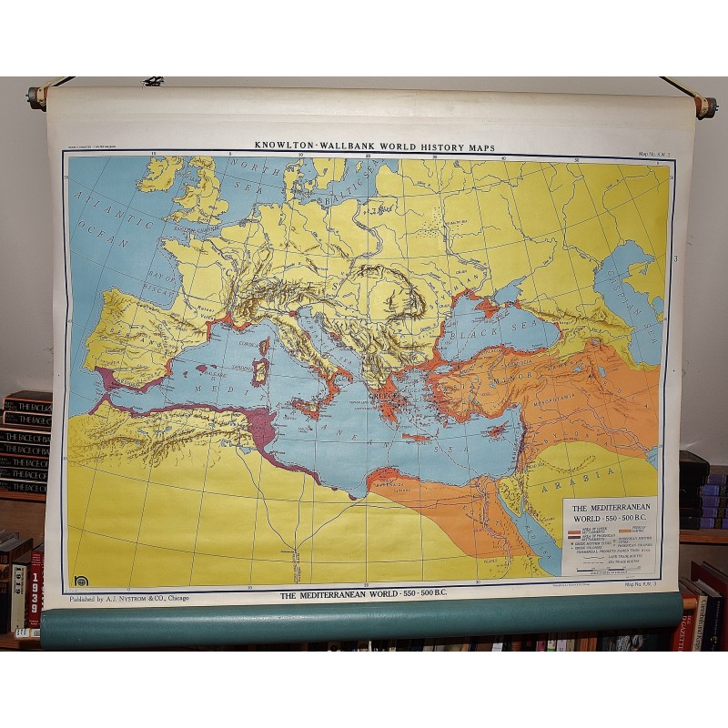
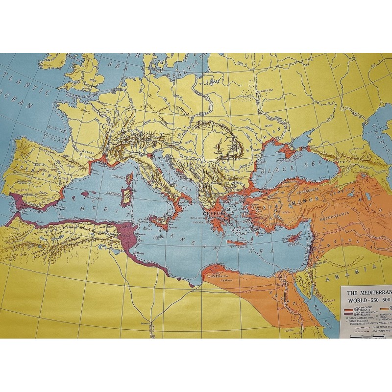
The Mediterranean World, 550-500 B.C. (Large Pull Down Map)
Click Image for Gallery
The Mediterranean World, 550-500 B.C. (Large Pull Down Map)
Daniel C. Knowlton (Cartographer), T. Walter Wallbank (Cartographer), A.J. Nystrom and Company
A.J. Nystrom & Co., Chicago, 1955
93 x 126 cm. Mounted on muslin, wood rods top and bottom. Knowlton-Wallbank world history maps, map no. K.W. 3, Map No. K.W. 3. Map showing Greek and Phoenican settlements, mother cities, and colonies as well as the Persian Empire, commercial products, and land and sea trade routes. Relief shown by shading. Scale approximately 1:4,752,000. Scale 75 miles to the inch, (W 20--E 60/N 60--20).
Note: This is a large, heavy map. Additional postage will apply depending on delivery location