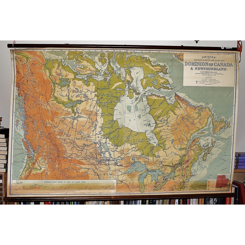
The Dominion of Canada : Philips' Comparative Series of Large School Maps (Large Pull Down Map)
Click Image for Gallery
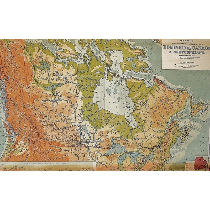
The Dominion of Canada : Philips' Comparative Series of Large School Maps (Large Pull Down Map)
George Philip & Son, London Geographical Institute
George Philip & Son, 1933
Mounted on wooden rollers. 118 x 183 cm. (47 inches x 6') Relief shown by gradient tints and spot heights. Depths shown by gradient tints. Scale 1:3,000,000. 48 miles = 1 inch. Hanging bands broken.
Note: This is a large, heavy map. Additional postage will apply depending on delivery location.