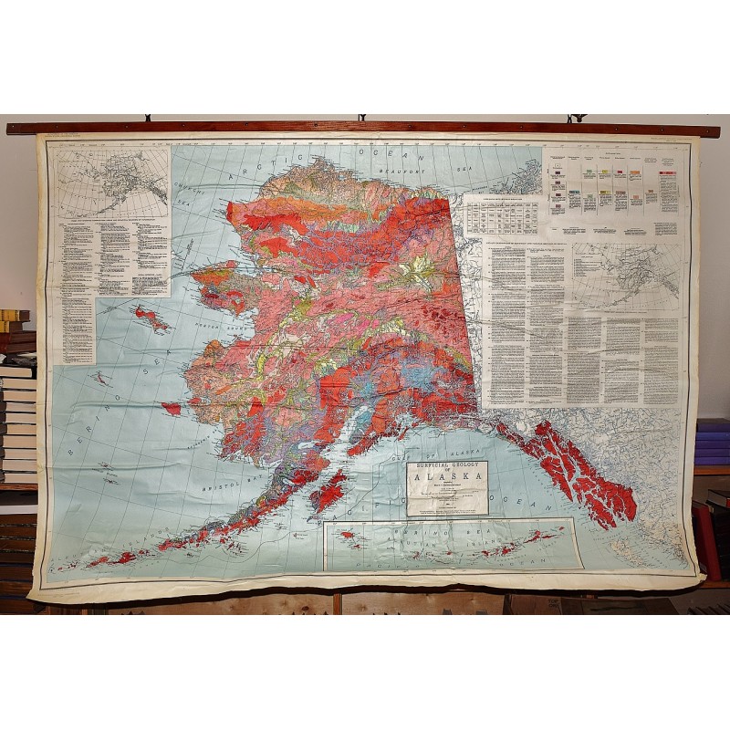
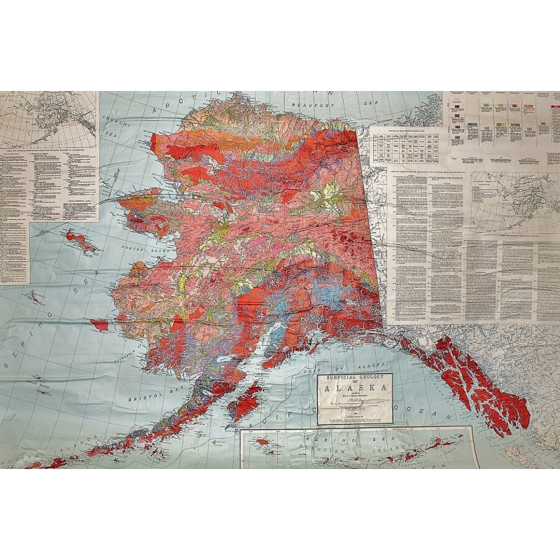
Surficial Geology of Alaska (Large pull down color map)
Click Image for Gallery
Surficial Geology of Alaska (Large pull down color map)
Geological Survey (U.S.), Thor N. V. Karlstrom
Dept. of the Interior, U.S. Geological Survey, Washington, D.C, 1964
Mounted on muslin, wood rods top and bottom. 135 x 191 cm. Map has some wrinkling. Relief shown by contours and spot heights. Contour interval 1000 feet. Datum is mean sea level. Insets: Western Aleutian islands, "Index map showing compilation areas and principal sources of information", and "Index map showing geographic regions." Includes "Locality descriptions of significant sections or erractics", "Named glacial drifts included in morraine units", and legend. Scale 1:1,584,000. 1 in. = approx. 25 miles, (W 174--W 130/N 72--N 54). Miscellaneous geologic investigations, map I-357
Note: This is a large, heavy map. Additional postage will apply depending on delivery location.