Mitchell's School Atlas: Comprising the Maps, etc., Designed to Illustrate Mitchell's School and Family Geography
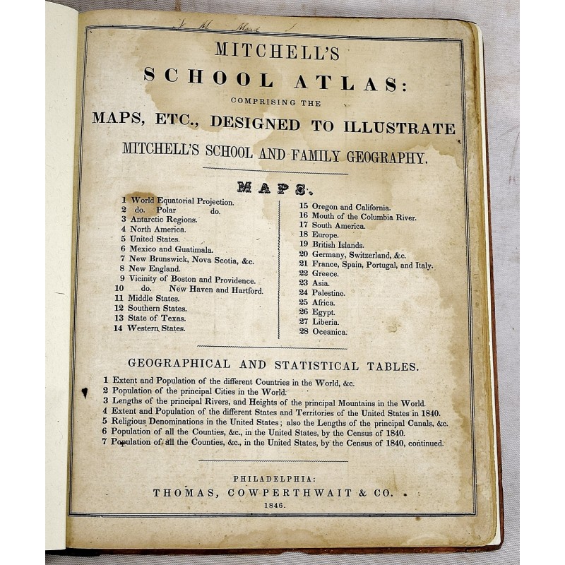
Mitchell's School Atlas: Comprising the Maps, etc., Designed to Illustrate Mitchell's School and Family Geography
S. Augustus Mitchell
Thomas, Cowperthwait & Co., 1846
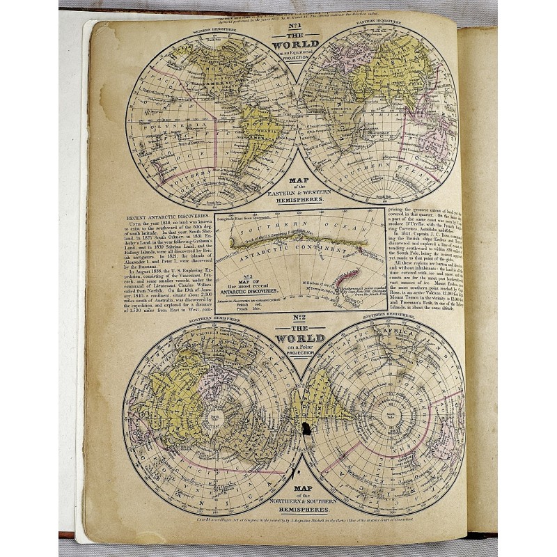
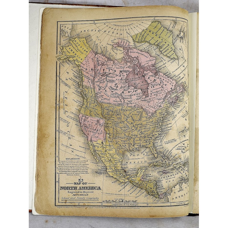
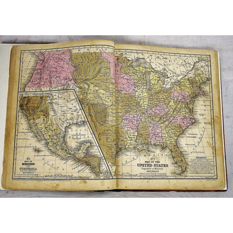
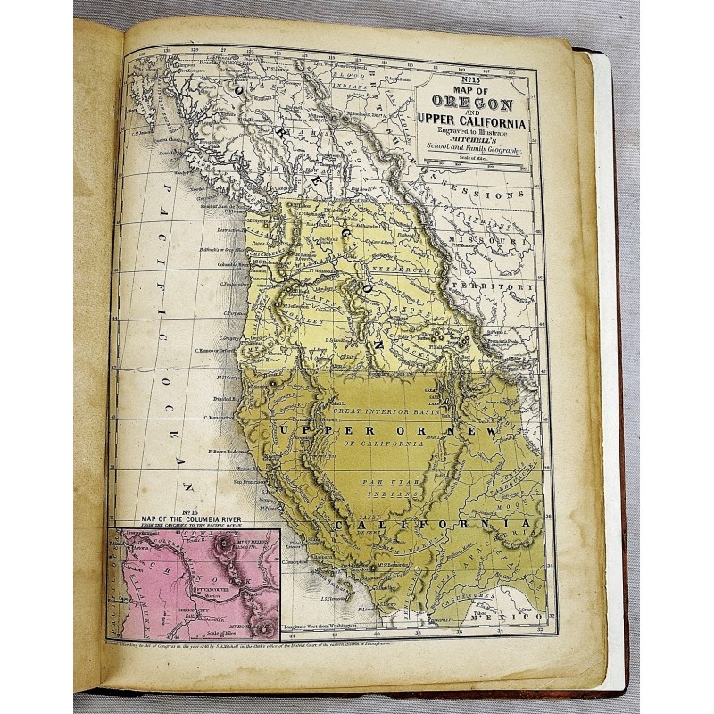
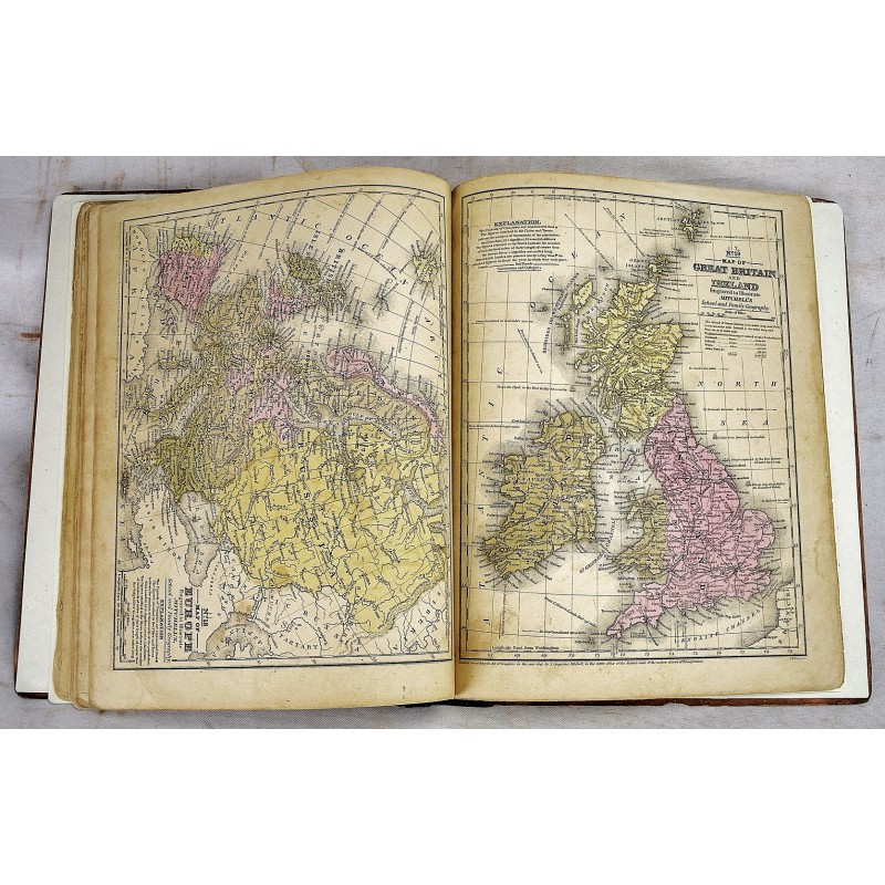
Bound in publisher's printed boards. Hardcover. Rebacked. 8 pages : complete with 28 color maps ; 31 cm. Maps dated 1839-1846. Staining. Contemporary signature of Elizabeth W. Mead, Ashton. Milo Francis Mead. Contents:1. The world, equatorial projection; 2. The world, polar projection; 3. Antarctic regions; 4. North America; 5. United States; 6. Mexico and Guatimala; 7. New Brunswick, Nova Scotia, &c.; 8. New England; 9. Vicinity of Boston and Providence; 10. Vicinity of New Haven and Hartford; 11. Middle States; 12. Southern states; 13. State of Texas; 14. Western states; 15. Oregon and California; 16. Mouth of the Columbia River; 17. South America; 18. Europe; 19. British Islands; 20. Germany, Switzerland, &c; 21. France, Spain, Portugal, and Italy; 22. Greece; 23. Asia; 24. Palestine; 25. Africa; 26. Egypt; 27. Liberia; 28. Oceanica.