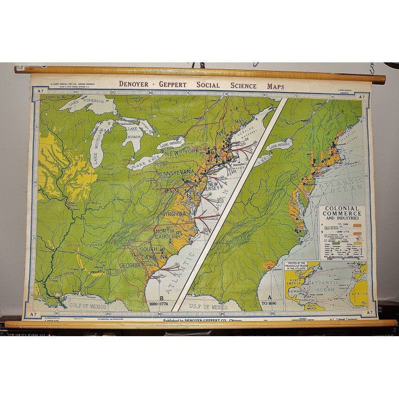
Colonial Commerce and Industries (Large Pull Down Map)
Click Image for Gallery
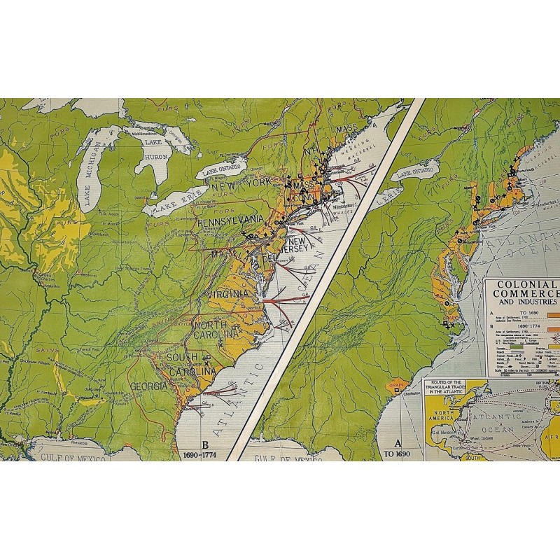
Colonial Commerce and Industries (Large Pull Down Map)
Albert Bushnell Hart, L. P. Denoyer, R. Baxter Blair
Denoyer-Geppert Company, 1961
110 x 80 cm. Mounted on muslin, wood rods top and bottom. 2 maps. Contents: A. To 1690; B. 1690-1774. Scale ca. 1:3,000,000. 1 in. = 50 mi., (W 94--W 65/N 48--N 30). Denoyer-Geppert social science maps, A7. An inset of the routes of the triangular trades in the Atlantic. Goods listed on the map include tobacco, grain, cattle, fur, skins, flour, lumber, masts, rum, and more.
Note: This is a large, heavy map. Additional postage will apply depending on delivery location.