Christian Europe and the Crusades (Large pull down color map)
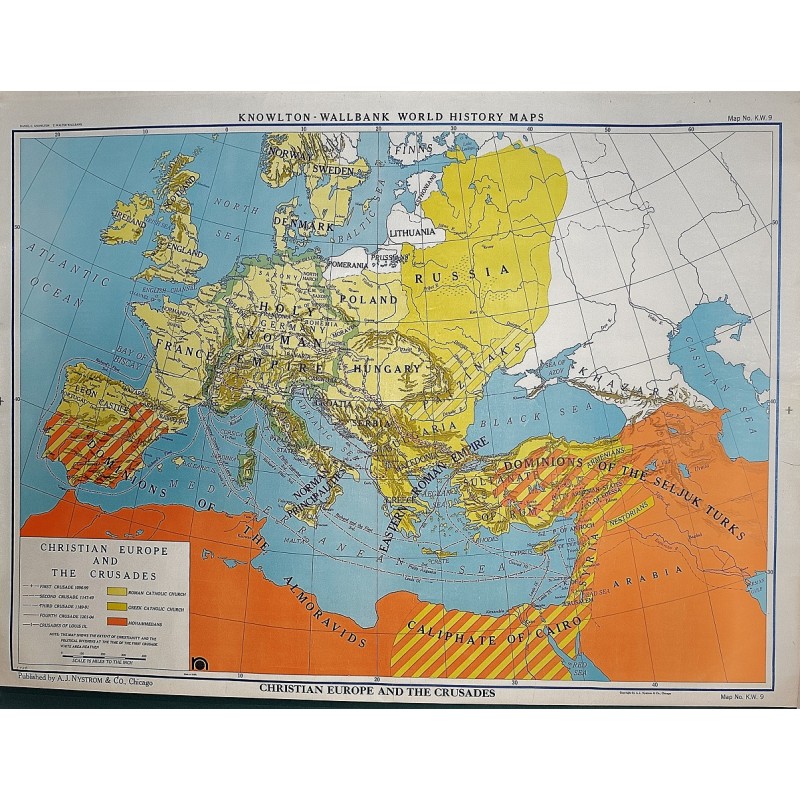
Christian Europe and the Crusades (Large pull down color map)
Daniel C. Knowlton, A.J. Nystrom and Company
A.J. Nystrom and Co., Chicago, 1955
Large pull down color map of the Holy Land. Muslin fabric. Fitted with wood rods. 94 x 126 cm. 37 1/2 x 50 inches. Knowlton-Wallbank world history maps, KW9. Scale approximately 1:4,752,000. Relief shown by shading. Insets: Eastern Roman Empire, 10th and 11th centuries -- Mediterranean lands after the fourth crusade (1204). Includes note of "The map shows the extent of Christianity and the political divisions at the time of the First Crusade." The main part of the map shows Roman Catholic, Muslim, and Orthodox Christian areas; Crusade routes; Crusader victories; Muslim victories; and areas where Jews were massacred. An inset shows the Crusader states in 1140, and a timeline shows major events of the Crusades from 1092–1291. Note: This is a large, heavy map. Additional postage will apply depending on delivery location.