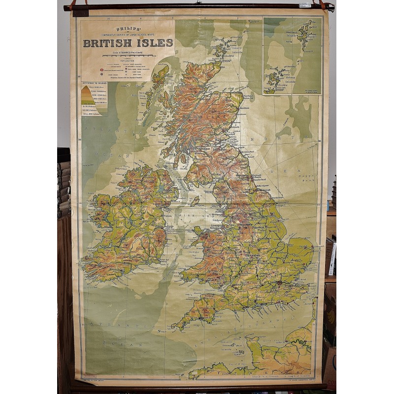
British Isles: Philips' Comparative Series of Large School Maps (Large Pull Down Map)
Click Image for Gallery
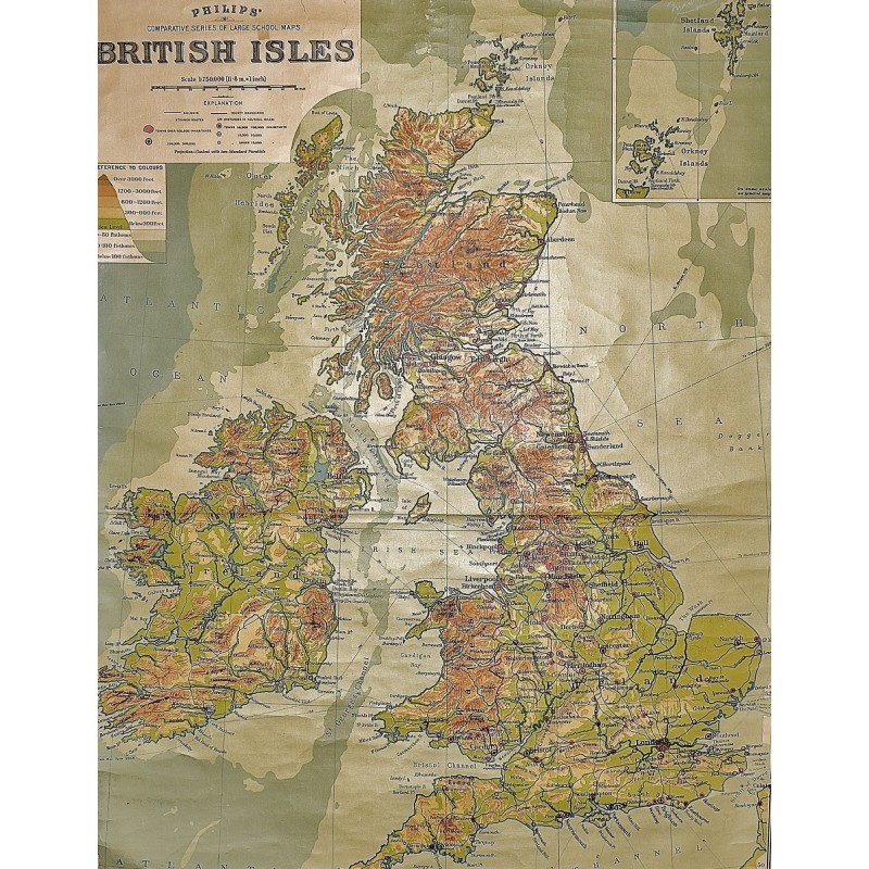
British Isles: Philips' Comparative Series of Large School Maps (Large Pull Down Map)
George Philip & Son, London Geographical Institute
George Philip & Son, London Geographical Institute, 1950
Mounted on wooden rollers. 119 x 178 cm. One chip missing, a few small cracks, tears. Hanging hooks/bands not included. Scale 1:750000, (approximately 11.8 m. = 1 inch). Shows: railways, steamer routes and towns with over 500,000 inhabitants. Inset: Shetland Islands on the same scale.
Note: This is a large, heavy map. Additional postage will apply depending on delivery location.